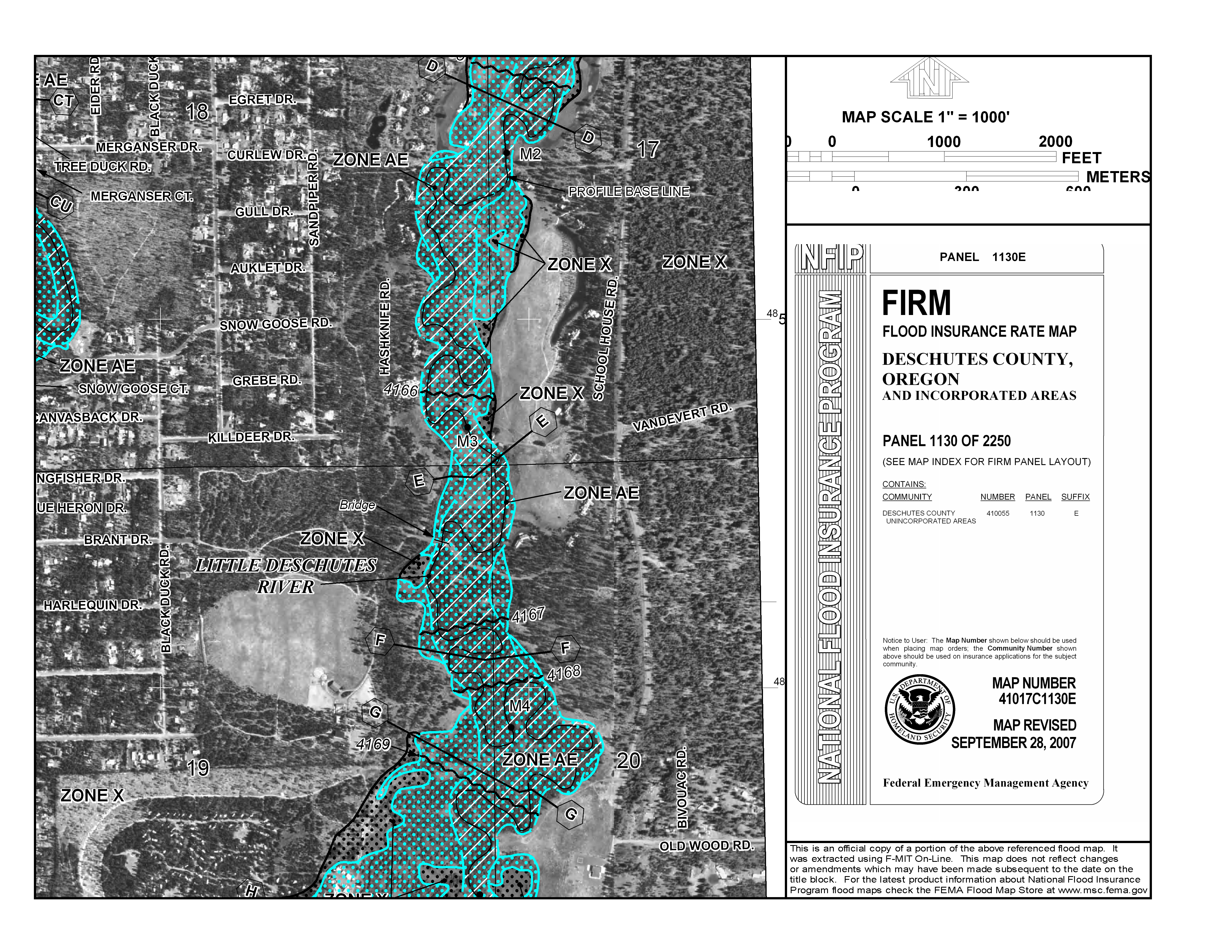
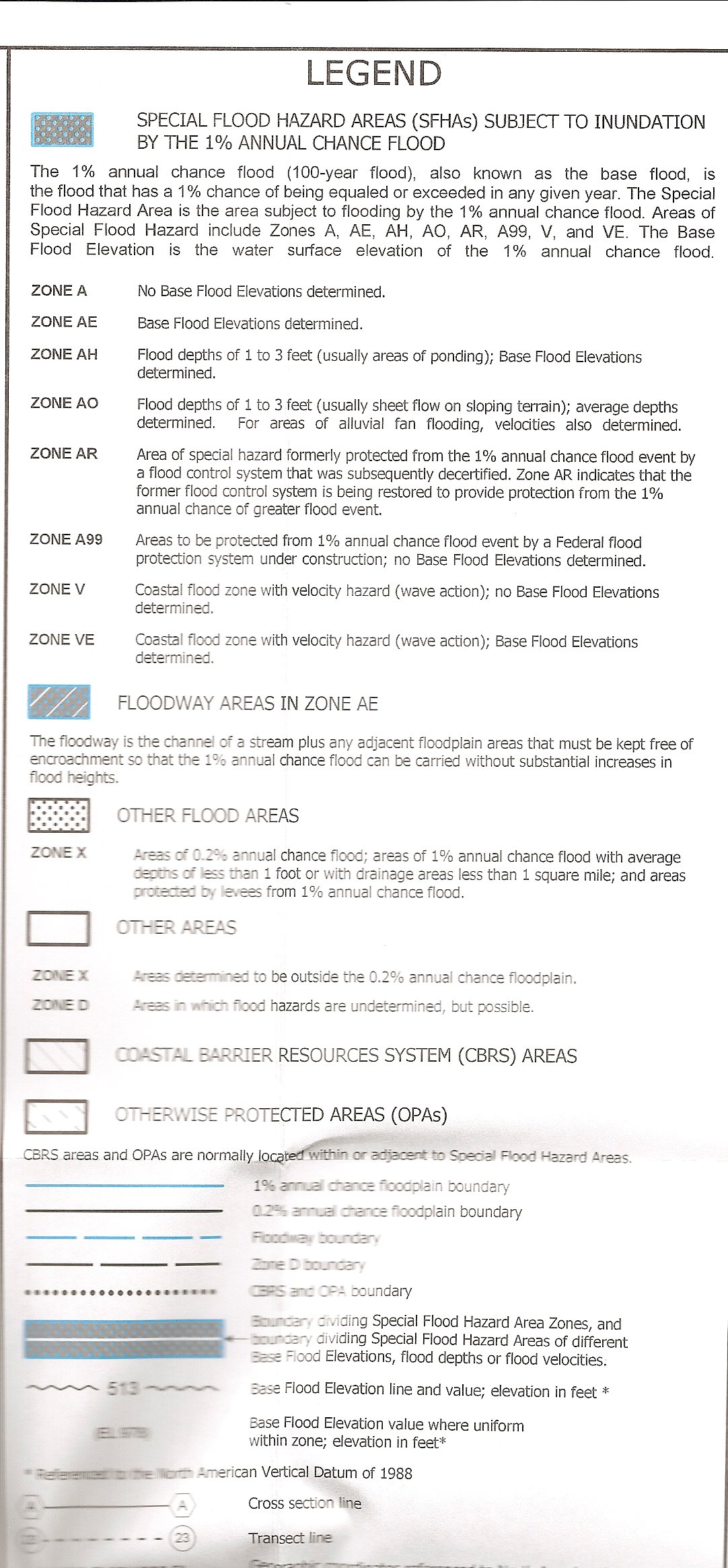
FEMA Flood Insurance Rate Map (See Legend and Notes Below Map)
This map is useful for identifying the 100-year floodplain of the Little Deschutes in the ranch, particularly areas in or near the floodplain that are not actually in it (Zone X) and for differentiating between areas subject to flooding versus areas which are critical to keep free of encroachment because they are necessary for carrying flood waters away. The 100-year floodplain has a 1% chance of being inundated in any given year. The County Zoning Map (which see) is more important for legal purposes because dictates where structures may and may not be built.
|
. |
Return to Stewardship Plan Table of Contents
Copyright 2004-2010 The Vandevert Ranch Association. Neither the Association nor its members guarantees the accuracy or completeness of information or representations on this Web Site. Buyers should obtain definitive information from their real estate agent