1979 Aerial Photos
The photos in the photo gallery below were taken in 1979 and are the
benchmark for determining, as part of the ranch Willow Management
Plan, where willows were growing along the river at that time.
The photos are cropped from a single analog photo provided by Bend
Mapping and Blueprint. The company generally flies over the
area every two years. Photos from more recent years are
digital from inception.
The willows are too small to see in a comprehensive photo of the
ranch. If the three photos were cropped smaller and magnified
the willows would get fuzzier and more difficult to distinguish from the
surrounding land.
In the central section, south of the Homestead Road opposite the
lone ponderosa, the large building is the old ranch barn and the
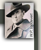
smaller building to the east is a toolshed built by Claude Vandevert
the elder.
In the photo labeled "Pasture" the area
where the current barn and large pasture are now was covered with
trees in 1979. A fire in 1990 burned the area clear.
South Century is at the far right of the photo.
|
|
|
|

|
|
|
|
Little Deschutes North Section - |
|
The river has since taken a shortcut cutting off the oxbow in the upper left of the photo. |
|
|
|
|
|
|

|
|
|
|
Little Deschutes River Central Section |
|
|
|
|
|
|
|
|

|
|
|
|
Little Deschutes River South Section |
|
The oxbow above and to the left of the center of the photo has since been cut off. The old oxbow is now the slough south of the teepee along the Paulina trail. |
|
|
|
|
|
|
|

|
|
|
|
Pasture - |
|
South Century is at far right. Homestead is in upper right corner. Note that area of current barn and pasture (on left) was completely forested in 1979. |
|
|
|
|
|
|
|
Return to
Vandevert Ranch Environment