Introduction to the Web Version (2006)
The following description formed part of a
Natural Resources Management Plan prepared for the developer by
Earl. E. Nichols, Professional Forester, S.A.F.-A.C.F. and signed by
the developer, Jim Gardner, on November 7, 1991. It was provided as
an Exhibit to a Fisheries Agreement between the Oregon Department of
Fish and Wildlife and the developer who signed it on January 9,
1993.
Comments interjected in November 2006 are
enclosed in [brackets].
Land Description
Legal – Parcel 1 W ½ SW ¾ Sec. 17, E ½ of SE ¼
Sec. 18, E ½ of NE ½ Sec. 19, W ½ of NW ¼ Sec 20, T20S, R11E W.B. &
M.
W.B. & M. 320.0
acres
Parcel 2 – W ½ of NE ¼ Sec. 19 T20S, R11E
W.B. & M. 80.0
acres
[Parcel 1 is the original Vandevert Ranch, on
both sides of the Little Deschutes. Parcel 2 is where the barn and
pasture are today. Parcel 2 is apparently the land that once
belonged to “Uncle Bill”. See the History Section of this web site
and find the arrow to Uncle Bill’s cabin on the 1935 Map.]
Location
The north boundary of Parcel 1 is 1 ½ miles
south of Sunriver and is one mile long [North/South] by ½ mile
wide. Huntington Road [actually South Century Drive] traverses the
east boundary. Parcel 2 is ¼ X ½ mile wide and adjoins the South ½
of the west line of Parcel 1.
All exterior property corners are U.S. brass
caps except one set by C.W.E at the N.W. corner of Parcel 1.
Conditions
Parcel 1 – The Little Deschutes River splits
this parcel, 187 acres being east of the river and 133 acres west.
Adjacent to the River is a 90 acre sub-irrigated or riparian zone of
which 48 acres is on the east side and 42 acres on west. The Forest
Zone (F-3) east of the riparian zone comprises some 139 acres and to
the west 91 acres also are zoned F-3. [The ranch is apparently now
zoned F-2 instead of F-3.]
According to the Corps of Engineers survey of
1984, the Little Deschutes River is slightly over 2 miles in length
as it meanders within the north and south boundaries of Parcel 1.
The river drops about 4 feet in elevation in the 2 miles.
[There is no description of Parcel 2 in the
“Conditions” section.
Historic Factors
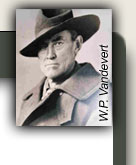
The Vandevert’s homesteading on Parcel 1 took
place in the 1880’s when land clearing took place on some 40+ acres
east of the center of the parcel. [Actually W.P. Vandevert bought
the land in 1892 from a party or parties who may have cleared some
of the land.]
An old photograph shows a number of stumps
still conspicuous in this area. According to Jeanie Vandevert, the
cleared area was used to raise hay to sustain 80 cows and calves
through the winter. The field was not irrigated. The cattle were
put on a government allotment, Spring River, June through October to
allow the home place to provide enough feed for the rest of the
year.
Only minimal logging of Parcel 1 occurred until
1989 when beetle infested and existing dead trees were removed.
Historically [the] Vandeverts removed only trees for products needed
for the ranch: fence posts, house logs, bridge timbers etc. In the
1970’s some trees were removed and cut on site for railroad ties on
the west side of the river, which appeared to be very selective high
grading. Some poles and posts were also removed in a glorified
thinning type operation on the east side in the early 1980’s by a
previous land owner. This was not effective. Parcel 2 has never
been logged, though there has been some heavy beetle kill in recent
years in the Lodgepole. Some salvage of older dead trees has been
undertaken over the years by woodcutters throughout the property.
Climatic Factors
The climatic factors of temperature and
moisture combined with soil conditions (light loam) create some
severe limiting conditions for desirable vegetation.
The poorly drained areas of the ranch are not
suitable for the establishment of Ponderosa Pine, a less freeze
resistant species than Lodgepole Pine. In the tree covered areas
where the snow lasts longer, Ponderosa Pine has a better chance of
survival.
The ranch receives approximately 18” of
precipitation per year, mostly in the form of snow in January and
February and occasionally into March. [Recent records show the
total in La Pine is 22.03” per year with the greatest average
precipitation in December (3.56 inches) followed by January (3.46
inches).] Once the surface (top 4” or 6”) becomes dry, subsequent
moisture to the soil surface is of little help to tree needs but
will do much for grass and shrub vegetation vigor and fiber
production. Thundershowers in June, July, and August fall into this
subsequent moisture category.
Once tree roots penetrate more than 4 feet into
the soil they are into layers of high suspended moisture content and
are able to maintain a fair rate of growth.
Soils
The soils on the ranch are primarily forms of
loam [loam is “a rich soil composed of clay, sand, and some organic
matter” – ranch soils tend toward the sandy] and generally are very
well drained.
The upper terraces on each side of the river
have an alluvial type loam with fine medium rock in smaller amounts
by volume. Few rock outcrops are found on both parcels. The lower
elevations, below the terraces, have Mazama Pumice to a depth of
36”. This is more of an ash type loam with very little rock. [Mazama
Pumice is from the eruption in 5650 B.C. of the volcano (Mt. Mazama)
that formed Crater Lake.]
These soils are easy to work for all types of
construction, agriculture and forestry. The primary drawback is the
surface drying effect making grass and tree establishment difficult
in dry years.
The ground slope is gentle to very gentle each
side of the river. The greatest drop is approximately 19 feet in
the NE portion of Parcel 1. The balance of the land is almost flat
until it joins the riparian zone where there is a gentle slope to
the river.
Vegetation – Parcel 1
The easterly portion of Parcel 1 (about 77
acres) which is adjacent to Huntington Road [actually South Century]
contains Lodgepole Pine with a scattering of Ponderosa Pine. The
majority of these trees are over thirty years old. A light cover of
bitterbrush and grasses are found under the trees. Between this
timber strip and the Riparian area is a 42 acre field of grass; this
is located in the northerly 2/3 of the east side. Grasses [and
other plants] found here are Fescue, Stipa [bunch grass], Stitanium
[can’t find any such plant], Brome , Lambs Tongue, Lupin,
Strawberry, Yarrow, Eradium [can’t find any such plant], and Indian
Paint [perhaps the author means Indian Paintbrush which grows in the
wetter areas].
Brush species are Bitterbrush, Rabbit Brush,
Currant, Vetch etc. Most of the Bitterbrush are younger plants.
Ponderosa Pine is generally found on the better
drained soils and are of mixed age from saplings to larger trees.
In the Spring of 1988, two-thousand Ponderosa
Pine and one-thousand Lodgepole Pine seedlings were planted in the
easterly portion of the 77 acre area (west of Huntington Road [South
Century]). [Obviously the vast majority of the ponderosas did not
survive.]
Parcel 1 would generally be described as
“Lodgepole-Bitterbrush-Fescue” under the eco-classification system.
A sampling of 3 dominant Lodgepole Pine trees
indicated that the trees could reach 100 feet tall, 24” D.B.H. at
100 years. This would indicate Site Class III for this species, an
above average growing site.
Stream side vegetation in the riparian zone is
important to water quality (purity and temperature) and wildlife
(food and cover), and should be managed accordingly with guidance
from State Fish and Wildlife to protect these values. Sedges, wild
iris, rushes, needle grass and other water seeking species are in
the riparian zone. In this zone, due to the lack of grazing, the
willows have increased considerably to where they are a detriment to
viewers, river access and grazing.
Vegetation – Parcel 2
This 80 acre parcel is mostly Lodgepole Pine
with a very light scattering of Ponderosa Pine. Mountain Pine
Beetle has killed over half of the merchantable volume, half of
which remains standing and a very serious fire hazard.
The younger stands in the westerly portion of
this parcel are not as severely infested as the rest of the parcel,
however, growth is becoming stagnated because of the dense nature of
these stands.
This parcel is critically in need of treatment
similar to that given Parcel 1, i.e. removal of beetle infested
trees, salvage of dead material and burning of the remaining
debris. [Apparently the developer did this.]
Grass – Browse
Parcel 1 has ample grass and browse to sustain
70-75 head of cattle for a year-round sustained commercial
operation. However, only limited grazing of horses is planned for
recreational purposes. A stock pond will be constructed to prevent
the need to encroach the wetlands for water. The recent logging on
this parcel should improve the quantity and quality of available
grasses by providing more sunlight and surface moisture for plants.
Basically, there are just two principal pastures, one on each side
of the river. Gophers are causing considerable damage to the grass
and browse, particularly in the open areas. If grass cover is to be
maximized, control of gophers will be necessary.
In Parcel 2, grass and browse production can be
improved with selective logging to maintain an open tree stand.
Seeding and appropriate land management can produce adequate
quantities of grasses for grazing and wildlife.
Wildlife – Parcels 1 and 2
There are no limiting factors for the major
wildlife species on these parcels. There is ample protective cover
in timber and willow patches. Year-round water is running through
the property. Food is ample to plentiful in form of grasses and
shrubs for browsers. Birds have a good variety of seeds and fish.
Except for elk, most animal species can be
found either resident to, or frequenting these parcels.
Ample snags and green trees are in use by
cavity nesting birds and sufficient potential trees and snags have
been saved by owner in the timber areas which have been treated.
Of the large birds, eagles, ospreys, a number
of hawk species, great blue herons, and crows have been seen on the
property. [The Sunriver Nature Center list of local bird species
includes ravens but not crows.] Rabbits, bobcat, and coyote have
also been observed.
This area is transitory range for deer and therefore their use is
light.
The Little Deschutes River, which is just over
2 miles in length, is all in Parcel 1. It is potentially a good
fishery and should receive proper protection and enhancement to
maintain this quality. [Enhancement assumed the placement of rock
jetties in the river which the developer was not able to do.]
Numerous riparian animals are along the river, i.e. beaver, mink,
otter (and possibly others) are obvious from sightings and evidence
found.
Trespass
Trespass by humans and cattle has been
prevalent in the past. This has been accompanied by open fires,
theft of forest products, illegal taking of wildlife, dumping, and
other activities that degrade the land.