Forest Description and
History Lodgepole pines
dominate the 230 forested acres on the ranch. Large ponderosas
punctuate the eastern portion of the ranch and smaller ponderosas
are growing near the riparian area, on the eastern portion of the
ranch, and in landscaping of individual lots. There are very
few ponderosas in the common areas west of the river. Dominant
understory plants are bitterbrush and wild currant.
The table below summarizes
the forest acres by stand in 1998 and changes since that time are
not reflected. See the
Forest Stands Map and Survey
Information in the appendices.
Forest Summary by
Stand
Stand |
I |
II |
III |
IV |
V |
VI |
VII |
Riparian |
|
Location |
East of So. Century |
Between So. Century & Schoolhouse |
Between So. Century & So. Access Road |
Between Barn and River |
Ranch Southwest Corner |
North of Large Pasture by Barn |
West of Hashknife Road |
River Corridor |
|
Acreage |
7.5 |
11 |
32 |
39 |
18 |
36 |
32.5 |
110 |
|
Forest Type |
Even-aged, single story |
Even-aged, single story |
Mixed age, two story |
Multi-aged, two story |
Multi-aged, two story |
Multi-aged, two-story |
Uneven age, two story |
Shrub, brush |
|
Species |
Lodgepole, scattered ponderosa |
Lodgepole, scattered ponderosa |
Lodgepole, ponderosa, few juniper |
Lodgepole, scattered ponderosa |
Lodgepole, scattered ponderosa |
Lodgepole, scattered ponderosa |
Lodgepole, scattered ponderosa |
Willows, scattered lodgepole |
|
Tree Density* |
700 – 900 |
200-300 |
90-130 |
300-500 |
500-700 |
500-700 |
400-500 |
Willow clumps |
|
Age |
50-60 years |
50-60 years |
60-80 |
Overstory 50-60, Under 5-10 |
Overstory 60-80, Under 5-20 |
Overstory 60-80, Under 5-20 |
Overstory 60-80, Under 5-20 |
Lodgepoles 30-40 |
|
Exposure |
Southwest |
West – Southwest |
South - Southwest |
Southeast - South |
South - Southwest |
South - Southwest |
Southeast - South |
South - Southwest |
|
History |
Natural |
Thinned 1998 |
Thinned 1998, 2003 |
Grown from old meadow |
Partial Thin 2007 |
Partial Thin 2007 |
Pre-commercial |
Recent planting |
|
Future Manage-ment |
Pre-commercial thinning. Brush removal |
Remove bitterbrush & selected trees |
Light commercial thinning |
Convert areas to ponderosa. Pre-commercial
thinning. |
Intensive pre-commercial thinning & fuels reduction |
Intensive pre-commercial thinning & fuels reduction |
More pre-commercial thinning, fuels reduction |
Nurture recent planting. Focus on wildlife. |
*Tree density is per acre and, except for Stand I, includes only
trees that were 6" or more DBH (diameter breast height or 54" above
grade). Stand I density includes virtually all trees.
Data is from cruise by Ranch Foreman in 1998. The seven stands add to 176
acres rather than the 230 total forested acres because the other 54
forested acres are sparsely forested or are on private lots. Lot owners are
required to reduce fuels in their forested lands.
Lodgepole pines
are shallow-rooted and relatively vulnerable to fire. They
sprout prolifically from seed and grow rapidly, often in dense
groves when young. Ponderosas are more deep-rooted and thick
barked. They resist fire better than lodgepoles but do not
replace their populations as quickly when destroyed by fire or
timber operations.
Forest History
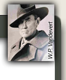
Prior to settlement by the Vandeverts in 1892 the ranch, outside
the riparian area, was a mixed lodgepole and ponderosa forest
periodically thinned by fire from lightening strikes. The
Vandeverts cleared the meadows east of the river and planted rye to
store in their barn and feed the cattle over the winter.
Limited cattle and sheep grazing kept the forests relatively free of
flammable brush. In the 1920's the Vandeverts sold many of the
ponderosas on the ranch to a lumber company which harvested them.
The family did minimal harvesting for their own needs - fence poles,
house logs, and bridge timbers.
The western 80 acres of the ranch (Stands V and VI around the barn and pasture) were not
part of the family ranch and were U.S. Forest Service land until the
modern developer swapped acreage located elsewhere for these 80
acres and combined them with
the ranch. Skid marks in aerial photographs indicated that
this area was logged, probably some time after 1950.
In 1990 a debris fire in Oregon Water Wonderland escaped and burned
what is now the pasture. Scattered ponderosas on this land are
thriving.
The ranch has done thinning and fuels reduction in selected areas
since 1998. Beginning in 2007, students in the
Lapine High
School Forestry Program have been learning forestry skills while
doing this work in the southwest corner and along the western border
of the ranch (stands V and VI).
Continue to Forest Issues and Challenges
Return to Stewardship Plan Table of Contents |


