Geologic/Lithologic Cross-sections
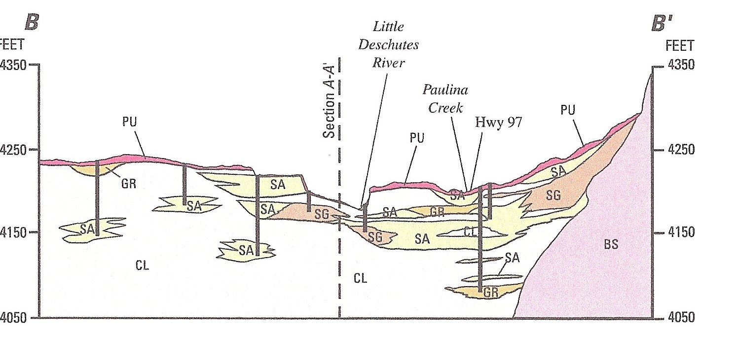
The first cross-section below runs west to east (B to B') through
the intersection of U.S. 97 and the Paulina-East Lake Road, about
six miles south of the ranch. Though the slope of the volcanic
rock on the right of the cross-section (labeled BS) is highly
exaggerated, the chart still clearly shows that Little Deschutes
flows through a valley of soils at least 200 feet deep with larger
particle soils (sand and gravel) overlying smaller particle soil
(clay-silt). Spotty deposits of pumice, probably all from the
eruption of Mt. Mazama (Crater Lake), cover the soil to varying
depths.
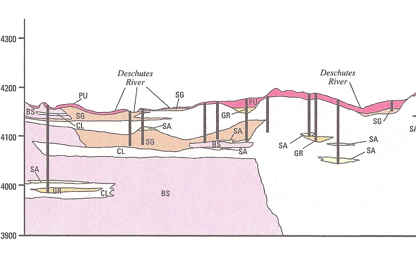
 The second cross-section, below, is a portion of a longer one that
runs from north to south (A to A') and passes about two miles west
of the ranch. The ranch is approximately opposite the highest
point of pumice between the triple intersection of the cross-section
with the Deschutes River on the left and the single intersection
with the river on the right. The second cross-section, below, is a portion of a longer one that
runs from north to south (A to A') and passes about two miles west
of the ranch. The ranch is approximately opposite the highest
point of pumice between the triple intersection of the cross-section
with the Deschutes River on the left and the single intersection
with the river on the right.
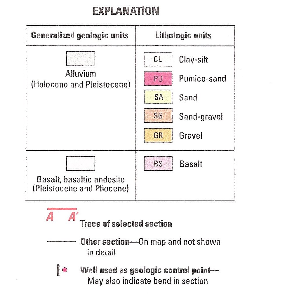
The lithographic cross sections and legend above are portions of
"SELECTED CROSS SECTIONS SHOWING LITHOLOGIC UNITS OF THE LA PINE
REGION, OREGON" By Rodney J. Weick and David S. Morgan, 2007,
Prepared by the U.S. Geographic Survey in cooperation with OREGON
DEPARTMENT OF ENVIROMENTAL QUALITY AND DESCHUTES COUNTY.
Continue to
Ranch Soils Map
Return to
Stewardship Plan Table of Contents |